I love maps; love to get the boys together on a slow winter
afternoon and pour over them, find places – sometimes right up the road – where none of us have ever been.
“You ever get up
in here?”
“No. You?”
And that faraway look goes around the table from fisherman to
fisherman.
Fly Fishing
Small Streams (1989) – By
John Gierach
It
was after the fact when I first made the connection. I had perhaps been shown the map long before
as a boy, but its relevancy failed to register at the time if indeed I had.
Almost
twenty one years ago now I caught my first trout. It was during the summer of 1997, just a few
months after my son was born. I had
attempted to catch them several different times while growing up, but it was to
no avail. For the last two decades or so
I’ve been able to make up for lost time, however, and reconnect with my lineage.
The
map had belonged to my Grandpa Orlo. He
had hunted, and fished, and explored the Northland of Michigan when much of it
was still wild in the first half of the last century. It was during a time when going “Up North”
took the better part of a day or so as the roads were only two lanes. One had to travel from small town to small
town back then, and if you branched off from those small state highways you
most likely would work your way down to dirt roads and narrow two-tracks.
 |
| Grandpa Orlo-Around 1930 |
Orlo
died when my own Dad was just 14 years old, but the nostalgia of him is
none-the-less set deep in my mind. Black
and white pictures, and stories passed down, add to his lore. The irony is that I was born just a stone’s
throw from an area he often stayed at with his family and friends when he
wanted to “get away” up North. But it’s
his old map that haunts me. It’s not a
haunting fueled by fear, or anxiousness, or uncertainty. It’s restlessness. Perhaps it’s more of a restlessness bound by
the spirit of adventure. I’ve been
introspective about that thread of my character, and have self analyzed it to
the point of trying to understand if I feel like I have to prove something or
live up to something. In my own
diagnosis it’s more about making a connection to a missing piece of the puzzle;
a piece of my heritage; a piece connected to the mark on that map that not too
long ago I didn’t even know existed. In
fact, as my other three grandparents lived well into their 90’s, it’s one of
the only unknowns in my link to my past.
My
Dad helped bridge that gap to Grandpa Orlo.
While both my Mom and Dad invested their time in nurturing my love for
the outdoors, Dad connected me to the fishing aspect. Tales of his days on the rivers and streams
are likewise etched into my mind. I’ve
been fortunate to have walked and fished some of those same classic waters my
Dad often fished. Since then my Dad and
I have even christened some of our own waters together. But even his stories are linked to a calling
from the past. It all comes back to that
old, faded map that he has. It’s held sacredly
in a leather briefcase; a satchel for all intents and purposes.
 |
| Dad and Teddy - 1965 |
The
map is a Michigan Road Atlas that was copy written four years after my Dad was
born, in the throes of World War II. It
was used I’m sure a few years after, when life and the world as a whole was a
bit more grounded. It was then that the
map received the mark. It’s a mark that’s
hardly noticeable, written in a dull pencil, and drawn in an obscure part of
the state. Orlo drew that mark; an “X”
really, at the end of a trailing, twisting line that extended up from a small
town in Northern Lower Michigan.


Enter
my cousins and me. For the better part
of ten years now we’ve met, bonded, and rooted ourselves within the North Country
over a camping expedition. We camp an
easy drive from the area where I was raised; out in the “sticks” and “back-country”
as they say. That first year, 2008 to be
exact, we explored the area’s rivers and tried to get our bearings on the best
places to go; our favorite places to go.
It was the last day of that first year’s outing, while out driving and
exploring, that we happen chanced upon a small river that immediately captured
our hearts. It was the setting. It was the waters. It was all of these parts bound together in a
synergistic sort of way that hasn’t released its grip on us yet. In fact, it’s only been tightened. Each year since, we set aside a day, a holy
day really, to spend alongside that snaking waterway. We arrive early, cook breakfast (sometimes
even adding the area’s blueberries to our pancakes), fish, rest (sometimes after
a run and swim), cook a dinner of brats, sauerkraut, and beans, and then head
back to our base camp at dusk. It’s a
day well spent. Fishing the sandy
bottomed currents with its deep bends, for the elusive, beautifully marked
trout, is only one small facet of what makes the area and excursion so enticing
year after year.
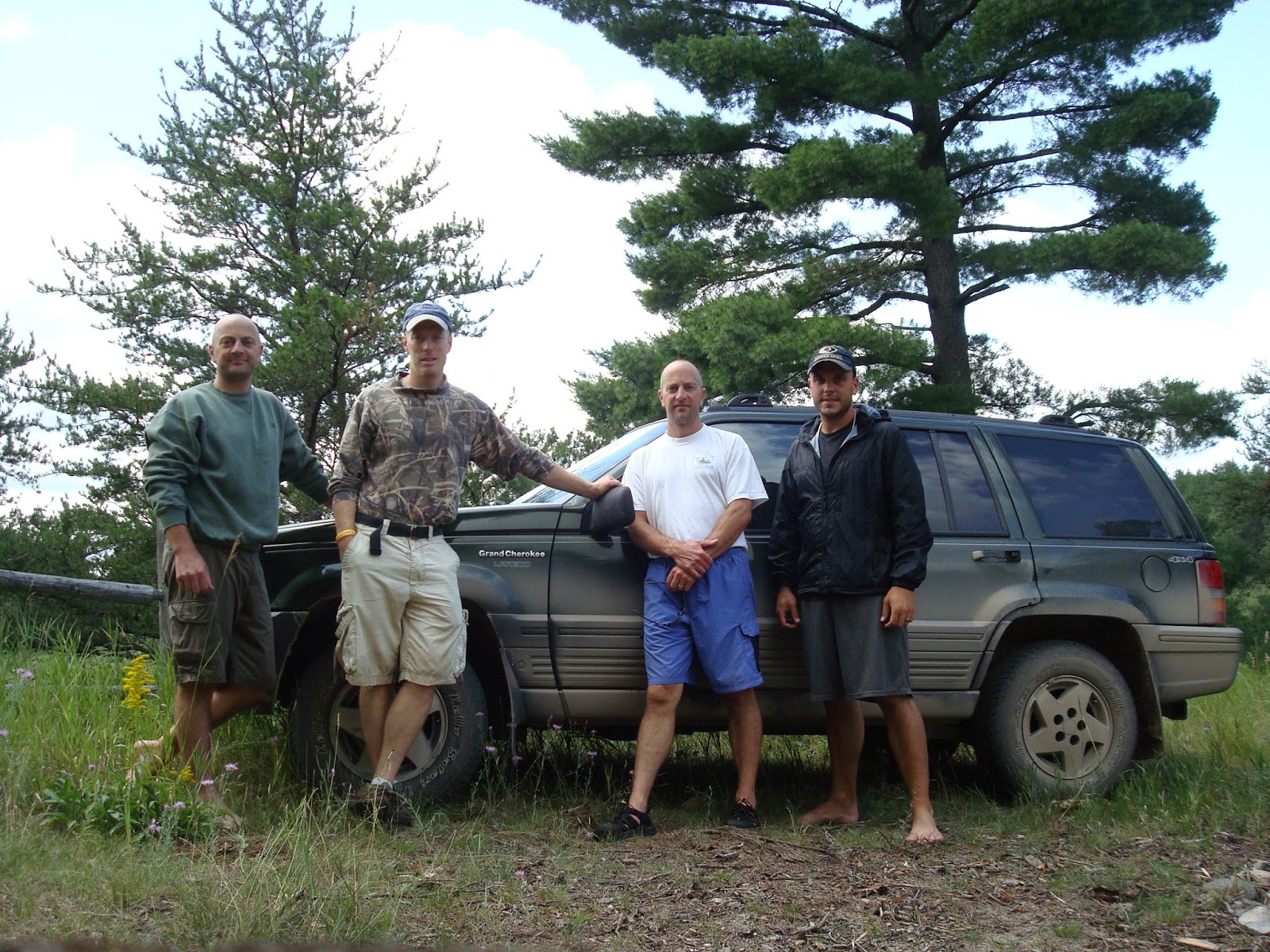
 |
| Brad, Brian, Sean, and Me - The First Year: 2008 |
What
happened was innocent enough, but while sitting and talking at my parent’s
house three years ago now, the subject turned to fishing, “back home”, and maps. My Dad went downstairs and came back up with
that brown, leather satchel. In it was
the (now coveted) map. It instantly
became the missing link when I saw the penciled mark; the “X”. The mark was located on the river of our
dreams where we spend that holiest of days each year. Incredibly it was just a few bends down from
the hillside ridge where we typically camp out for the day. I could hardly believe what I was
seeing. After explaining to my Dad the
coincidental connection between where my cousins and I fish each summer and the
mark on Grandpa Orlo’s map, I quickly took a picture. I sent the picture with a text to my cousins
who were equally excited. We now had a
direct association with our Grandpa. He
obviously must have felt a bond to the location to have placed an “X” on his
map. We, his grandsons, had unknowingly discovered
that same relationship to this tract of land hidden deep in the North Country.


A
veil had been removed, a mystery revealed, and a piece of the puzzle put into
place once we discovered the mark on that map.
Fishing an out of the way, special place had been our original
objective, but it has become much more than that now. Seventy years ago our Grandpa walked these
same sacred banks and fished these same clear waters. Can you imagine what it looked like seventy
years ago? Can you imagine if he could
know that his grandsons had found this place to be equally sacred? Some of our favorite white pines line that
river. It’s Michigan’s official state
tree. My cousins and I have taken a
bazillion pictures of those hallowed trees that were most likely small
seedlings when the North Country was first lumbered off in the late 1800’s. They are considered the originals by today’s
standards. Their boughs, the boughs that
whisper secret stories of the past with the ridge’s easy breezes, often shade
us on our excursions and meanderings on that one special day we spend there
each summer. It’s a day we set aside
reverently apart from our base camp on another river a few miles away. Those same pine boughs once shaded and
whispered to our Grandpa Orlo as young trees.
He spent that time walking the same ground and fishing the same
waters. It’s holy ground now, as it was
then, and more than worthy of a precious, faded, mark on an old map.
See
you along The Way…
----------
The Picture Album
 |
| 2009 |
 |
| 2010 |
 |
| 2012 |
 |
| 2013 |
 |
| 2014 |
 |
| 2015 - At "The Mark" |
 |
| 2017 |
 |
| The Day Camp |
 |
| Breakfast (Wild Blueberries Added) |
 |
| Dinner (Brats, Kraut, Beans) |
The Fish
 |
| A Leaping Trout |
 |
| Sean - 2011 |
 |
| Brad - 2013 |
 |
| Mike - 2013 |
 |
| Brian - 2013 |
 |
| A Favorite White Pine |
 |
| A T-shirt To Commemorate " The Mark" |
 |
| Finishing My Journal Entry For This Blog On A Cold, Blustery. Spring/Winter Day |


